There is a big storm coming in over us this week and I thought I’d share a blog post I’ve been thinking about for a while. And while we’re at it – let’s see how they predict the coming week.
I admit it. I am a true weather geek. My daily routine during the winter months includes browsing at least five different weather sites as soon as I open the computer, even if I have a full week of office work in front of me. And then again at lunch. And before I go to bed.
People are constantly telling me that we are living in the age of the nerd – apparently everyone now loves a geek. Well, let me tell you that if you have ever witnessed the glazed mix of bewilderment and pity spread across your friends’ faces as your lecture on the low pressures over the Atlantic Ocean (that might hit Engelberg soon!) ends, you’ll know that real life isn’t quite like that.
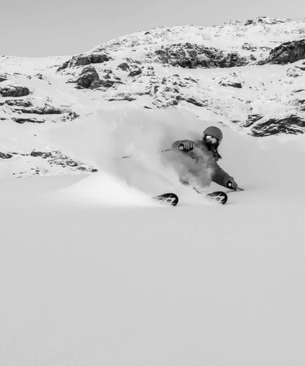
The reason Ski Lodge even exists today is because Engelberg enjoys a very special microclimate, resulting in one of the deepest snow packs in Alps, closing in on the more famous snow magnets like Mt Baker or the Kootenays in Canada. Last year the snow depth at the top stopped at 633cm.
My ski trips nowadays include a rental car and an iPad, constantly keeping track of the weather and driving back and forth over Italy, Switzerland, France and Austria while discussing precipitation, freezing levels, millibars and snow quality. As a self-proclaimed weather geek, I thought I’d share some of my best ways to become 100% informed about the weather in the Engelberg valley.
Snow-Forecast.com is the biggest information source for skiers. Their best feature is the hour by hour forecast so you can pinpoint the weather system and see how it’s going to hit Engelberg. Don’t look too much at the cm forecasted though, they rarely get it right. Usually it snows roughly double the forecasted the amount on Titlis – or the storm dissappears from the radar completely. They predict 35cm until Saturday.
Yr.no is a norwegian newcomer, but their crystal ball is surprisingly accurate. Their best feature is the long term forecast and the hour by hour. They predict 84cm for the coming week.
Meteoblue.ch used to be a good source of information, but since last year they’ve been on a constant streak of overestimating every low pressure by about 200%. So take everything they say with a grain of salt, or use it as an upper on a gloomy November morning. Meteoblue goes all in and predicts….. 158cm (!)
SLF.ch won’t actually give you any forecasts, but they update their sites with accumulated snowfall 24hrs/72hrs in the morning so you know what to expect on the mountain. And, they are the best source for avalanche information in Switzerland, both for the long term trends as well as regional avalanche bulletins. And if you’re as nerdy as myself, you are going to love their annual snow roundup, a comprehensive write-up of the whole snow season.
The nerdiest insider tip of them all is Landi.ch, the forecast service for the agricultural sector in Switzerland. They work with probabilities instead of mm-forecasts, and their prediction is 25 – 95% probability for precipitation above 15mm (15cm snow) over Tuesday, Wednesday and Thursday. If millibars is your bag, you’ve come to the right place.
So we’re looking at a snowy week at least – it going to be very interesting to see where it lands, if it’s crust, wind blown, buttery, blower pow… Oh wait, that’s probably another blog post on snow quality. If you have more good forecast sources, or can predict the weather through the sounds of marmots or similar, give me a shout below. Looking forward to a deeeep winter.
//Eric
