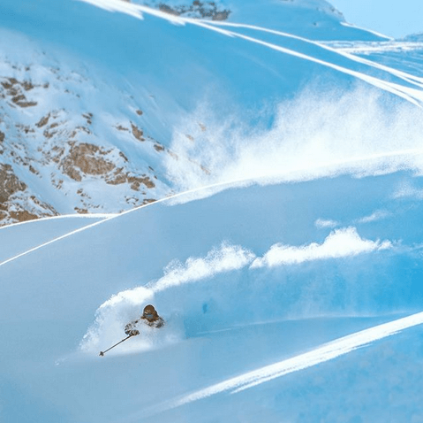
PHOTO: Elias Lundh RIDER: William Larsson
Midweek Package seems to be the best deal this winter!
This week, no different from the last. New snow on Tuesday and Wednesday day/night and a foggy wake-up call. Above 2800m it was sunny almost all day with some clouds rolling in and out, but on the top, it was as fine as it can be. Top part a bit wind-packed though. The heavy clouds didn’t roll out until Thursday Morning, But then what a day it was. Blower powder and lots of cold snow to cover up your knees and beyond. If you went one turn searching you could dig yourself in pretty deep. Two teams where here filming this week. DPS Skis and clothing brand Stellar Equipment. No sour faces in sight, despite the foggy start they got to experience some of the finest powder this season! It was great having both of them in and around the house, and we think they got what they came for…
We are getting a reset next week, so go on and get down here midweek, come by and see for yourself!
Hard Facts:
Snow depth Mountain (slope, 3.020m): 665 cm
Snow depth Location (1.050m): 20 cm
Snow condition: Powder!
Latest snowfall: yesterday
Avalanche alert level: Significant
Danger description
The mostly small snow drift accumulations of the last few days are in some cases prone to triggering. They are to be found in particular adjacent to the ridge line and in pass areas. At elevated altitudes, avalanche prone locations are more prevalent and the danger is slightly greater. Careful route selection is recommended.
Wet avalanches as the day progresses, Full-depth avalanches
As a consequence of warming during the day and solar radiation moist snow slides and avalanches are to be expected. Below approximately 2400 m individual full-depth avalanches are possible, including quite large ones. Caution is to be exercised in areas with glide cracks.
Wind
Sunday
Monday
Weather and conditions:
- http://www.bergfex.com/engelberg/schneebericht/
- https://www.meteoblue.com/de/wetter/vorhersage/woche/engelberg_schweiz_2660902
- http://www.slf.ch/schneeinfo/index_EN
- http://www.titlis.ch/de/titlis-gebiet/wetter
https://www.instagram.com/p/Bgl5305HK2V/?taken-by=william_larsson
https://www.instagram.com/p/BgobRFxlqH3/?taken-by=oskar_enander
https://www.instagram.com/p/Bgofr6CAtlM/?taken-by=mattiasfredrikssonphotography
// Ski Lodge Team

